Malta – key data
Area: 316 km²
Population: 408,333 (July 2011 estimate, CIA). The Maltese population is made up of descendants of Carthaginians and Phoenicians with strong influences fromItalians and other Mediterranean peoples together.
Population density: 1,292 people per km²
Population growth: 0.375% per year (2011, CIA).
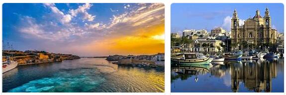
Capital: Valetta (6,300 residents, 2005)
Highest point: Ta’Dmejrek (near Dingli), 253 m
Lowest point: Mediterranean Sea, 0 m
Form of government: Malta has been a republic since 1974, represented in the Commonwealth. The Maltese Constitution dates from 1974, the last constitutional amendment was made in 1987. The unicameral parliament of Malta consists of 65 members. Malta has been independent from Great Britain since September 21, 1964 and a member of the EU since May 1, 2004.
Administrative division: 68 municipalities, of which in Malta:
Attard, Balzan, Birgu, Birkirkara, Bir? Ebbu? A, Bormla, Cospicua, Dingli, Fgura, Floriana, Gudja, G? Ira, G? Arg? Ur, G? Axaq,? Amrun, Iklin, Isla, Kalkara, Kirkop, Lija, Luqa, Marsa, Marsaskala, Marsaxlokk, Mdina, Mellie? A, M? Arr, Mosta, Mqabba, Msida, Mtarfa, Naxxar, Paola, Pembroke, Pietà, Qormi, Qrendi, Rabat, Safi, San? Iljan (St Julian’s), San? Wann, San Pawl il-Ba? Ar (St Paul’s Bay), Santa Lu? Ija, Santa Venera, Senglea, Si ?? iewi, Sliema, Swieqi, Ta ‘Xbiex, Tarxien, Valletta, Vittoriosa, Xg ? ajra,? abbar,? ebbu ?,? ejtun,? urrieq
on the island of Gozo:
Fontana, G? Ajnsielem, G? Arb, G? Asri, Ker? Em, Munxar, Nadur, Qala, Victoria (Rabat), San Lawrenz, Sannat, Xag? Ra, Xewkija,? Ebbu?
Head of State: President George Abela, since April 4, 2009
Head of Government: Prime Minister Joseph Muscat, since March 11, 2013
Language: the official languages in Malta are Maltese (90.2%) and English (6%). Italian is a widely spoken colloquial language.
Religion: Roman Catholic 98%, Islam 2%
Local time: CET. Between the last Sunday in March and the last Sunday in October, Malta has summer time (CET + 1 hour).
The time difference to Central Europe in both winter and summer 0 h.
International phone code: +356
Internet identifier:.mt
Mains voltage: 240 V, 50 Hz
The Republic of Malta is an island nation in the Mediterranean Sea and includes the Maltese islands of Malta, Gozo, Comino and the uninhabited islands of Cominotto and Filfla. The island of Malta, which is equidistant from Gibraltar and Cyprus, covers a total area of around 246 square kilometers and is 27 kilometers long and 14.5 kilometers wide.
A total of 137 kilometers of coastline surround the island of Malta, which has a number of natural harbors in the east and north, which are located in bays cut deep into the country. The south and west are largely inaccessible, as steep cliffs protrude from the sea here.
The interior consists mainly of a slightly undulating plateau without forests, mountains and rivers. The area, which is mainly used as arable land, is divided into terraced fields, which are separated from each other by walls made of field stones and hedges. Between the fields the otherwise rather monotonous and rather barren landscape loosened up by oleander and fig trees.
Malta’s geological formation dates back to the Tertiary era, which formed the island about 60 million years ago. A sandstone layer followed by a limestone crust covered. Over the course of millions of years, the island gradually rose out of the water until the island assumed its present shape around five million BC.
The constant wind blowing over Malta also contributed significantly to the design of the island. The heavy rains in winter soften the topsoil of the higher regions of the plateau and carry it down into the valleys, where a thick and fertile layer of earth forms. These intensively agriculturally used areas are repeatedly interrupted by rugged limestone hills.
The Rabat-Dingli plateau dominates the west and southwest of Malta and is made of hard limestone. The plateau drops steeply to the sea in the south, while in the east the hilly landscape typical of Malta was formed by wind and rain. In the north, the plateau gradually flattens out to end in a lowland zone.
the The island of Gozo, on the other hand, consists mainly of blue clay, which is rich in minerals and provides fertile soil. The vegetation is correspondingly more lush here, which earned the island the nickname “green Gozo”. Similar to Malta, the merciless deforestation has resulted in an unstoppable karstification of the soil.
Since the islands of the Maltese archipelago consist largely of limestone, deep caves have formed in the soft stone over time, which were also used for residential purposes in the past. Worth seeing and extremely bizarre stalactite formations can be admired in the caves Xerri’s and Ninu’s Grotto in Xaghra.
Natural water resources such as lakes, rivers and streams are lacking in Malta, so the water shortage has always been a major problem for the Maltese islands. Subterranean fresh water resources were distributed to the islands with the help of aqueducts and in 1982 the first seawater desalination plant made a significant contribution to the secure drinking water supply on Malta.
Best time to travel to Malta
Suitable travel months are especially from May to the beginning of November. In the period between June and August, however, very high temperatures can sometimes be reached, and UV exposure is also high. Visit vaultedwatches.com for best time to travel to Malta.